Sunday, February 26, 2012

Park 181- Chamizal National Memorial- El Paso, Texas


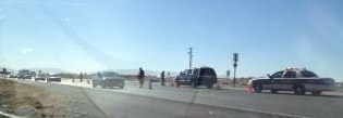
Chamizal is a memorial to the settlement of a border dispute between Mexico and the United States regarding the flow and path of the Rio Grande River at El Paso-  There had been a long dispute that was settled during President Kennedy's tenure, and enacted after he was shot by President Johnson.  There is a memorial on both sides of the river.  The location is right next to the International Bridge, and there was lots of traffic coming into and going out of the states.
The sign at the middle of the bridge in the middle of the photo is actually the sign for the Mexican border...
This was the original boundary, the new one  was created when the two countries decided to split the cost of running the Rio Grande inside a cement culvert. 

There is a fairly large park here, and they have several multi-cultural events on the grounds throughout the year. 

Watched a movie about the process, and got 4 stamps here, 3 for the memorial and one for the El Camino Real Trail.  Also got a park pin.


Here is the website from the NPS for here:

                                  http://www.nps.gov/cham/index.htm


Saturday, February 25, 2012

El Camino Real ed Tierra Adento National Historical Trail

On our visit today, February 24th to Las Cruces New Mexico, I stopped by the J Paul Taylor Visitors Center for the city of Mesilla, New Mexico, a suburb and secured the stamp for this trail, my first.  I checked one other location where the stamp was supposed to be, but they hadn't received it yet, and passed on another location- which we'll get on a revisit to the area. 
There are several locations for this trail in New Mexico and Texas

February 26, 2012-
Visited 2 more sites for this trail,

The Chamizal National Monument at El Paso, Texas, and also the El Paso Museum of History, located in downtown El Paso.


Park 180- White Sands National Monument, Alamagordo New Mexico

After parking in Las Cruces, New Mexico, we headed up about 55 miles on US 70 to get to White Sands.  Sadly, we encountered a fatal accident involving a car and a motorcyclist, and traffic was stopped for 45 minutes while they worked the scene, even as we were within a mile of the park entrance.  The wreck happened as the motorcyclist was pulling out of the park entrance, so they had it all blocked off, so they directed us to pull over on the side of the road, and we waited another 15 minutes, then they let us cross over and go into the park.

It must have been one hell of a wreck, there was impact debris all over the place, and they had the MAIT team out from the State Highway Patrol doing a detailed crime scene type of investigation. 

As we lost an hour or so, we still had time to drive into the park proper, after stopping at the VC for a couple of stamps.  We went in about 6.5 of the 8 miles, amazing dunes....


On the way back out, we stopped at the entry station and got that stamp, after Bette admonished me for not getting it on the way in, but because of the back up from the wreck, I thought it better not to ask then, with a long line behind us..  Anyway, we got the stamp. 

Then, as it was just at 4 pm, and we knew the movie was starting, we stopped back at the VC and watched the 18 minute movie about the park and how the dunes came into being, and about the wildlife and such.  Excellent movie. 

I also asked for the missing 25th Anniversary stamp, and got it, and then discovered I missed another stamp by not asking for it, but I did get 4 of 5. 

Drove home in about an hour and a half.  Beautiful park, Bette was glad she went. 

Got a pin and a hiking medallion...

Friday, February 24, 2012

Park 179- Ft Bowie National Historic Site, Bowie, Arizona

This trip was combined with a visit to Chiracahua- and besides Gila Cliff Dwellings, it is top on the list of "you really have to want to visit this park."
You go 8 miles first on a dirt road, that is very washboardy....
The GPS had a real struggle trying to get me here, it tried to several times have me leave the main road and go off on side roads, and at first said it was 21 miles, when in fact it was only 8. 

This leads you to a trail head, where if you are able, you can walk in 1.5 miles to the visitor center, which is actually at the scene of the old fort- 
I opted to go another 4 miles up the road to the handicapped entrance-

From the handicapped entrance, you parked in the utility lot/living quarters of the park, and then walked about 700 feet up a pretty good hill to the VC. 

The fort itself is right out the front door-  the fort was active as a defense post against the Apache uprisings of Geronimo and Cochise, and then abandoned in the late 1890's, and has since got to ruins. 


Got 2 stamps here, had to ask for the 25th anniv, and also a pin and a hiking staff medallion, and one for the National Parks as well. 

Park 178- Chiracahua National Monument New Mexico

I drove down here from our stop in Willcox, Arizona, and it was a beautiful sunshiny day, and this park is a WOW!  Essentially, it was the gift of an old pioneer family who settled here back in the 1880's, and labored to make sure the area was preserved as a National Monument-  glad they did! 

The park is situated in the Chiracahua Mountains, and is said to be an example of "standing up rocks,"  as a result of volcanic eruptions.  In 1934, the CCC did the roads and improvements, and the result is a pretty spectacular park as far as scenery is concerned. 

There is a small visitors center, and there was a nice movie-  and then I took an 8 mile scenic drive up to Massai Point, the highest point in the park at just over 6000 feet-  Wow!  Here's what it looks like:


Got a pin and a hiking staff medallion, and two stamps, as the database said there would be. 

Sadly, Bette didn't join me on this trip-  a miss for her! 

Tuesday, February 21, 2012

Park 177 Organ Pipe Cactus National Monument- Ajo Arizona

Set a new personal record for distance to a park today, going about 145 miles from Tucson and back-  Left Lazy Days at 0730, got to the park at about 1045- 
This park, while named for Organ Pipe Cactus, essentally is about the Sonoran Desert- 
This one, as you can see, is called "A Biosphere Reserve" so that Americans can be reminded of "how the earth was" before humans inhabited it and messed it up, or whatever it is we are doing to the planet. 


As I said, you go for a long drive in the primitive desert, with lots of accident shrines along the highway, and a small town here and there.  You also go by Kitts Peak National Observatory, but I opted not to visit it today- next time. 


It's about the desert....  There was a nice 14 minute movie, that explained about the Sonoran Desert, and the various wildlife-  I saw several cyotes along the drive in, and that this is a "young" desert, only 10,000 years old or so. 
Got a park pin, and two hiking staff medallions for the collection. 


There was only one stamp for the park- the 25th was not out.
I went through two Border Patrol stations on the way back, well down too, but didn't have to stop-  Was asked a lot of questions at the first one, where was I born, is this my car, how many passengers do I have? at the second, only asked was I a US citizen.  I did see two different instances of the Patrol detaining what appeared to be illegals on the side of the road, apparently they travel by foot, as this park is within 5 miles of the border.  Also saw tremendous amounts of equipment just sitting in motor pools which seems to be a constant with the Border Patrol-  Lots of stuff not being used. 

Friday, February 17, 2012

Park 176- Coronado National Memorial


Coronado National Memorial is one of those places that you sort of wonder why it was done in the first place-  It commemorates a failed expedition of about 8 years, and Coronado died in shame.... plus, this is basically a large plot of land in the middle of nowhere, but supposedly on the trail that he took in search of the fabled "7 cities of Gold." 

It's about 80 miles from Tucson, and an easy trip-  I also added side visits to Bisbee and Tombstone Arizona on the trip. 
This is from the NPS website, but shows the panorama of the park in general- it literally is in the middle of nowhere- The big thing for this park is to hike. 

Again, from the NPS website, a depiction of the journey that Coronado and his men took.

Another view of the park
Got a pin and a hiking staff medallion here. 

There's a visitor center, and that's about it.  The rest is trails.  You drive in about 5 miles off the road to the VC.


Here is the NPS website page for here, and the Wiki page as well.